Radfahren Australien NORD - SÜD


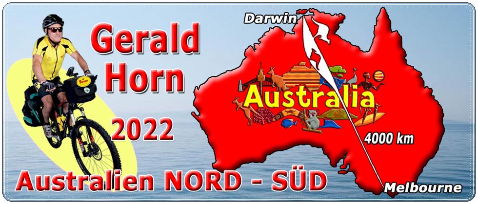
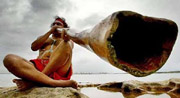
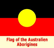
Australien, der ROTE KONTINENT
...mit dem Fahrrad 4000 km von NORD nach SÜD...
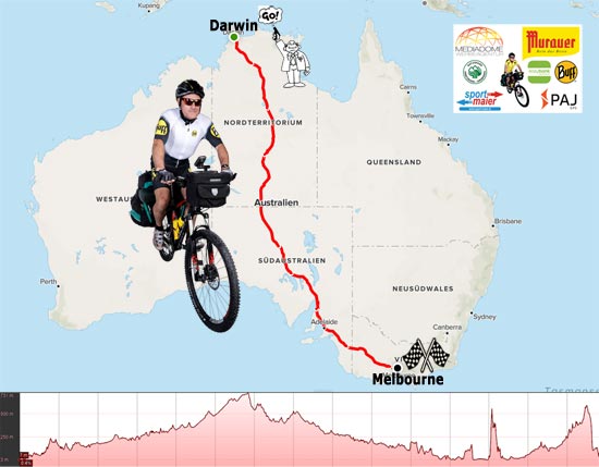
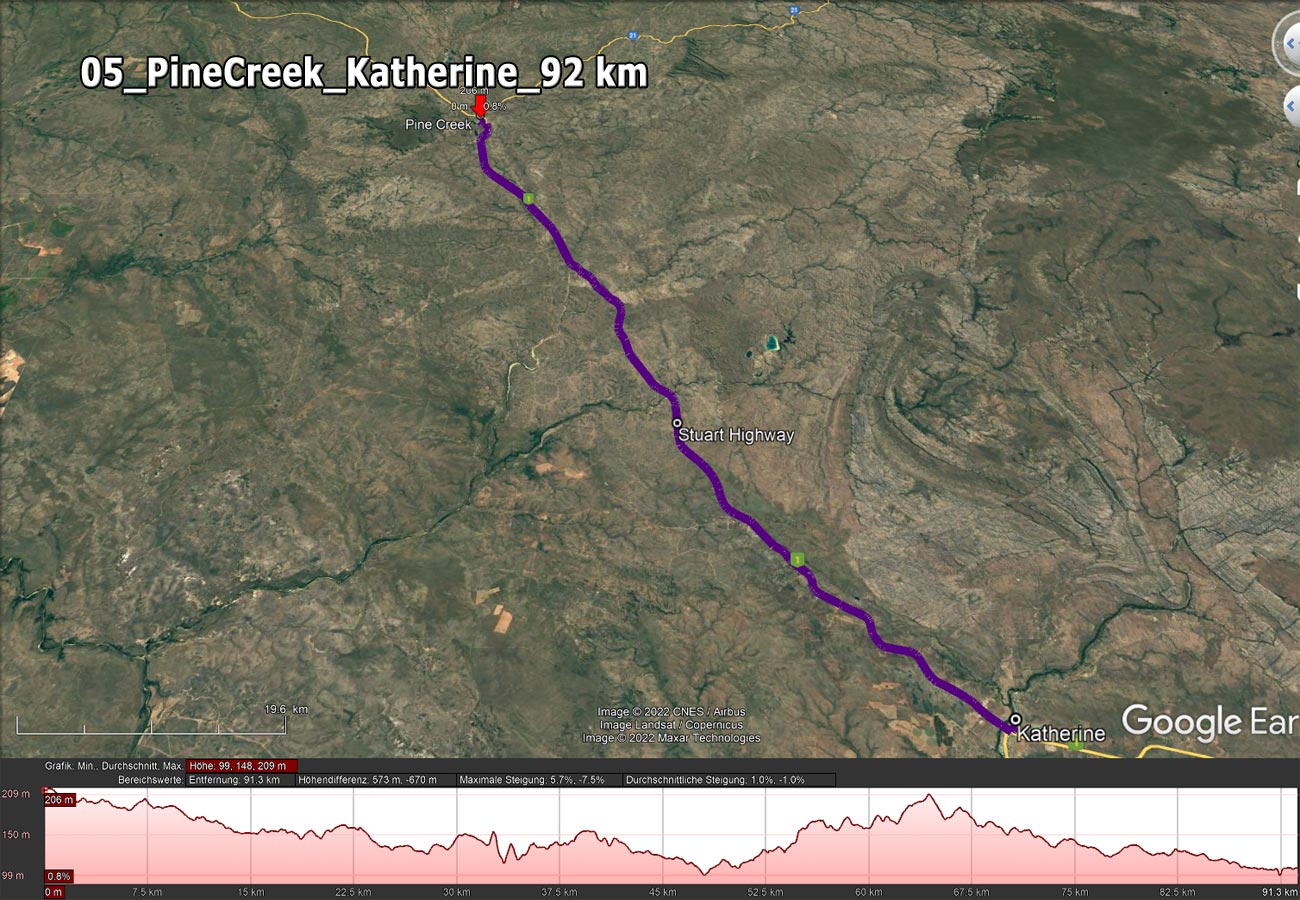
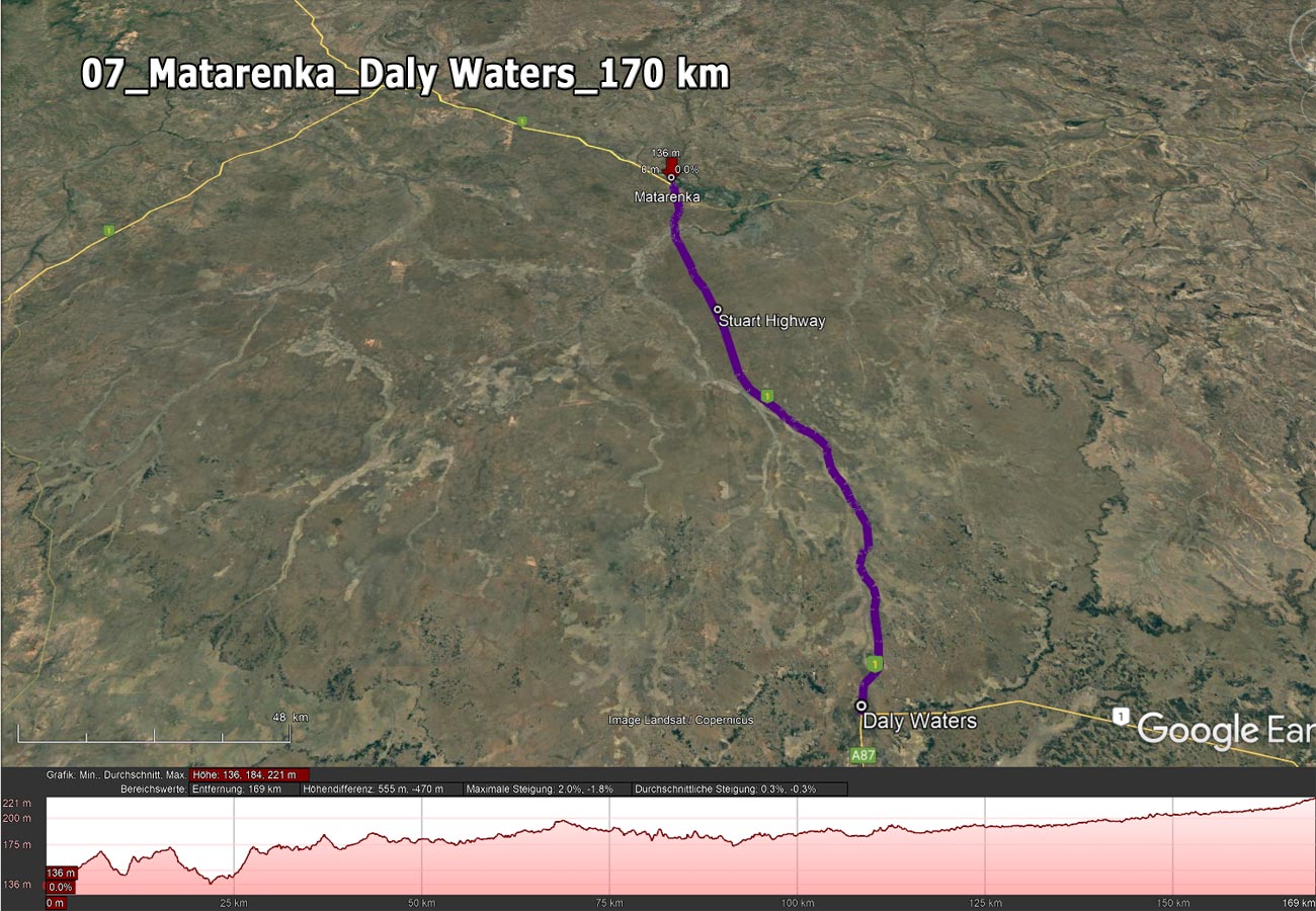
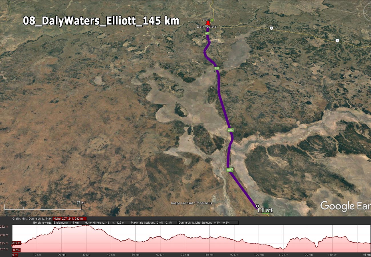
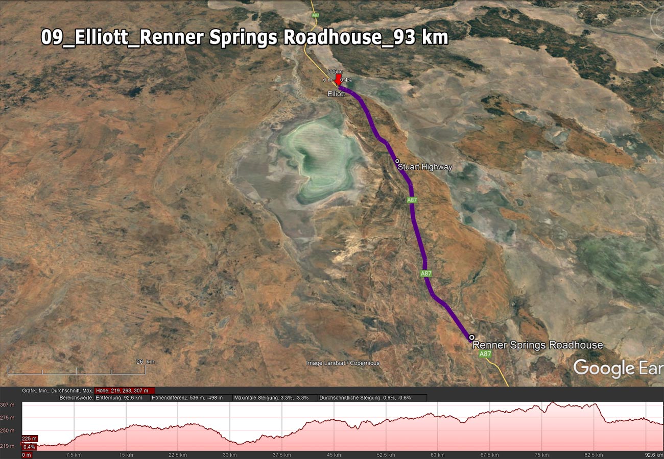
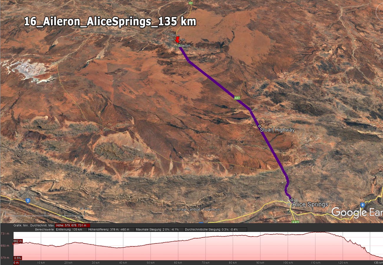
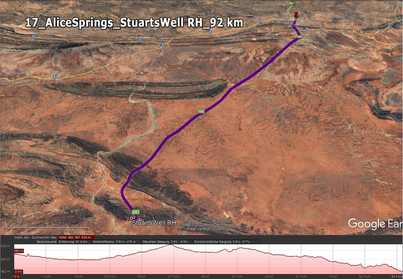
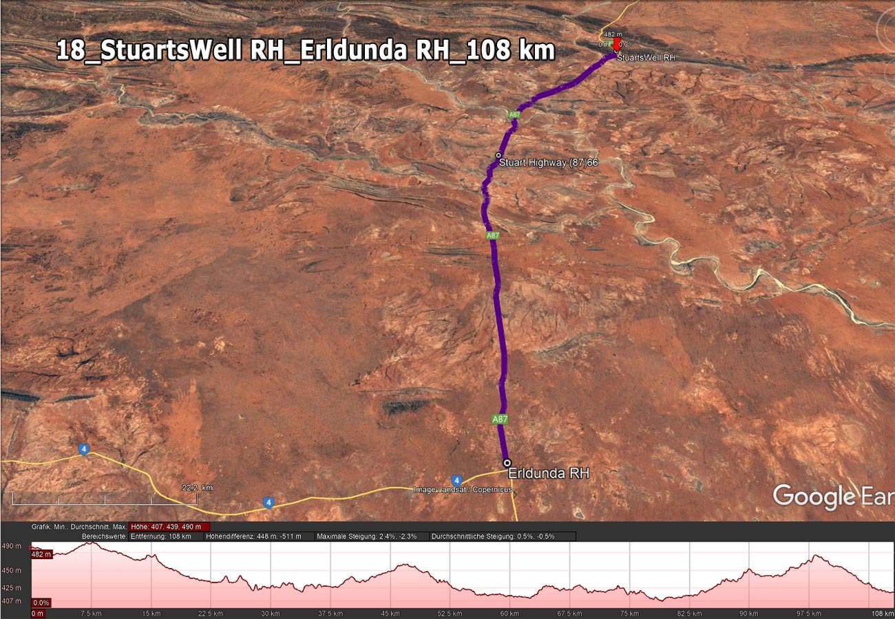
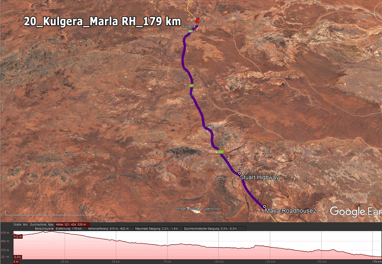
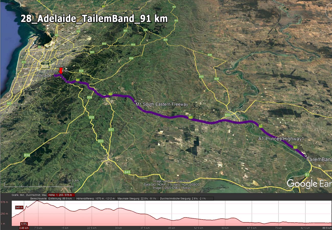
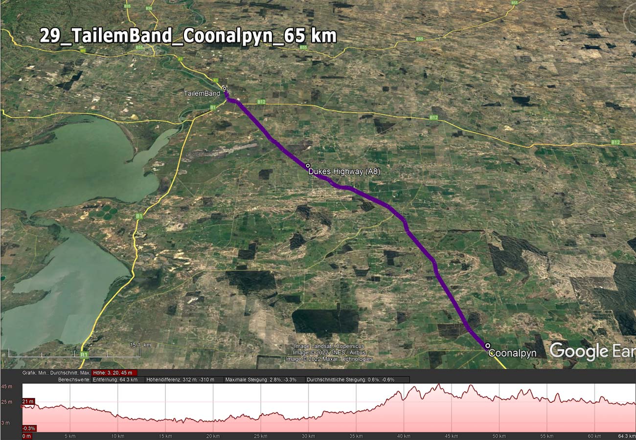
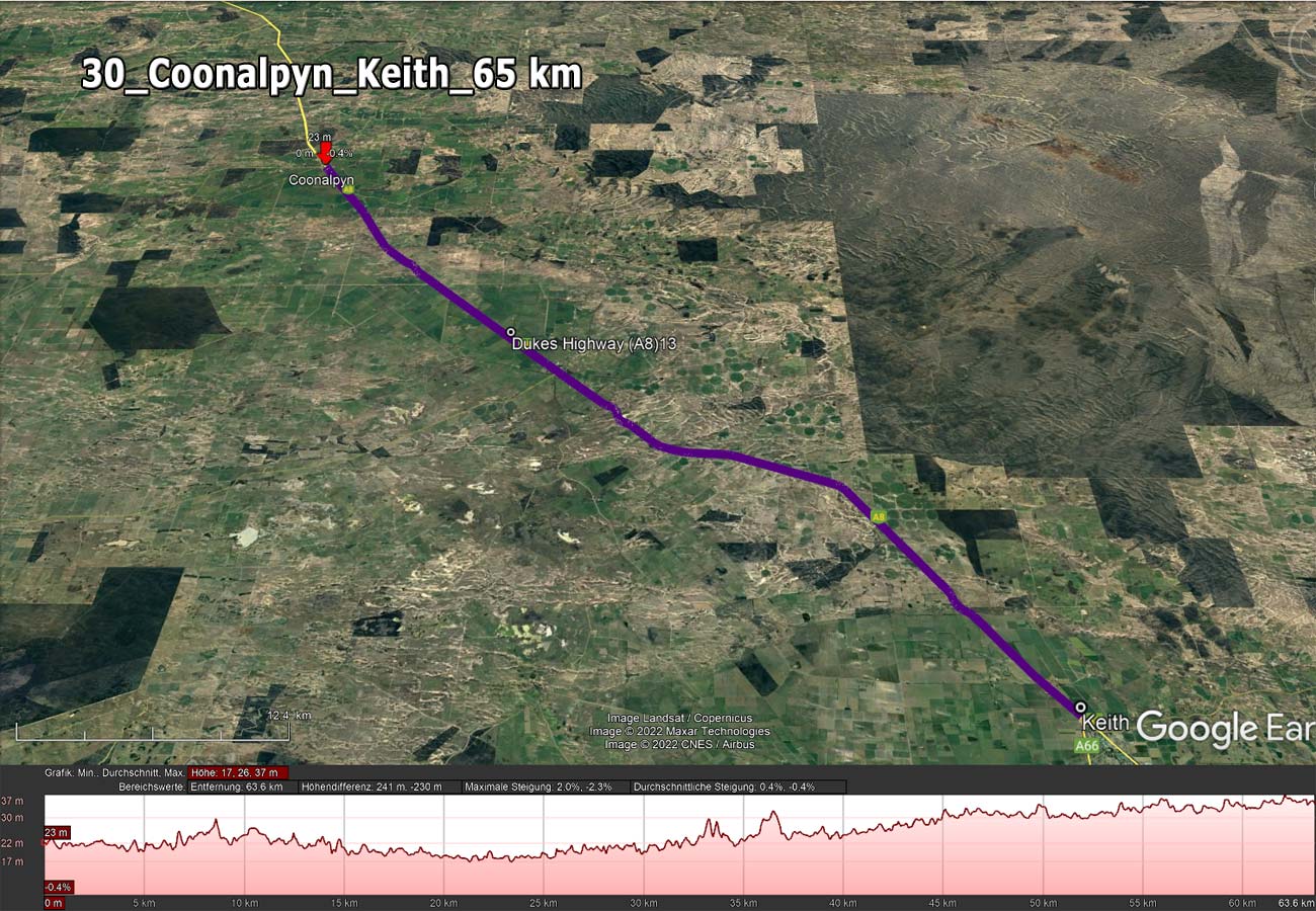
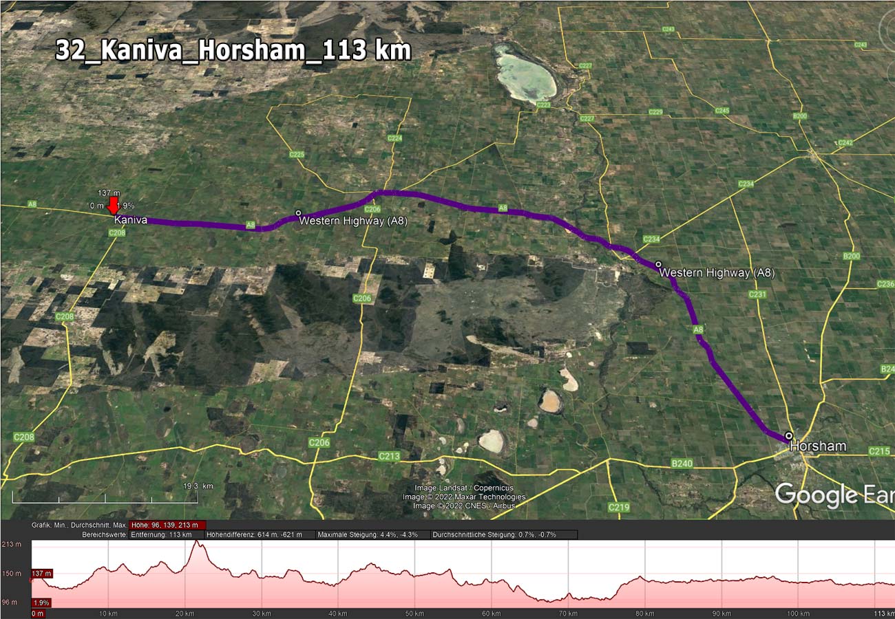
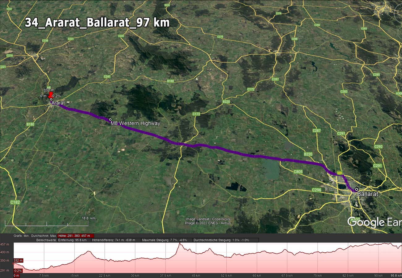
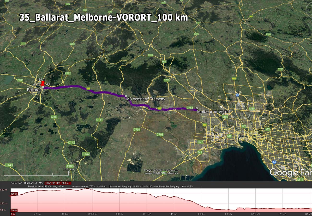
Die Gesamtstrecke

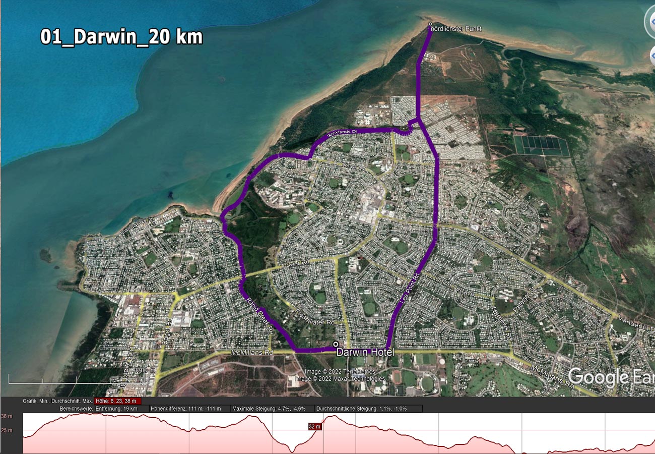
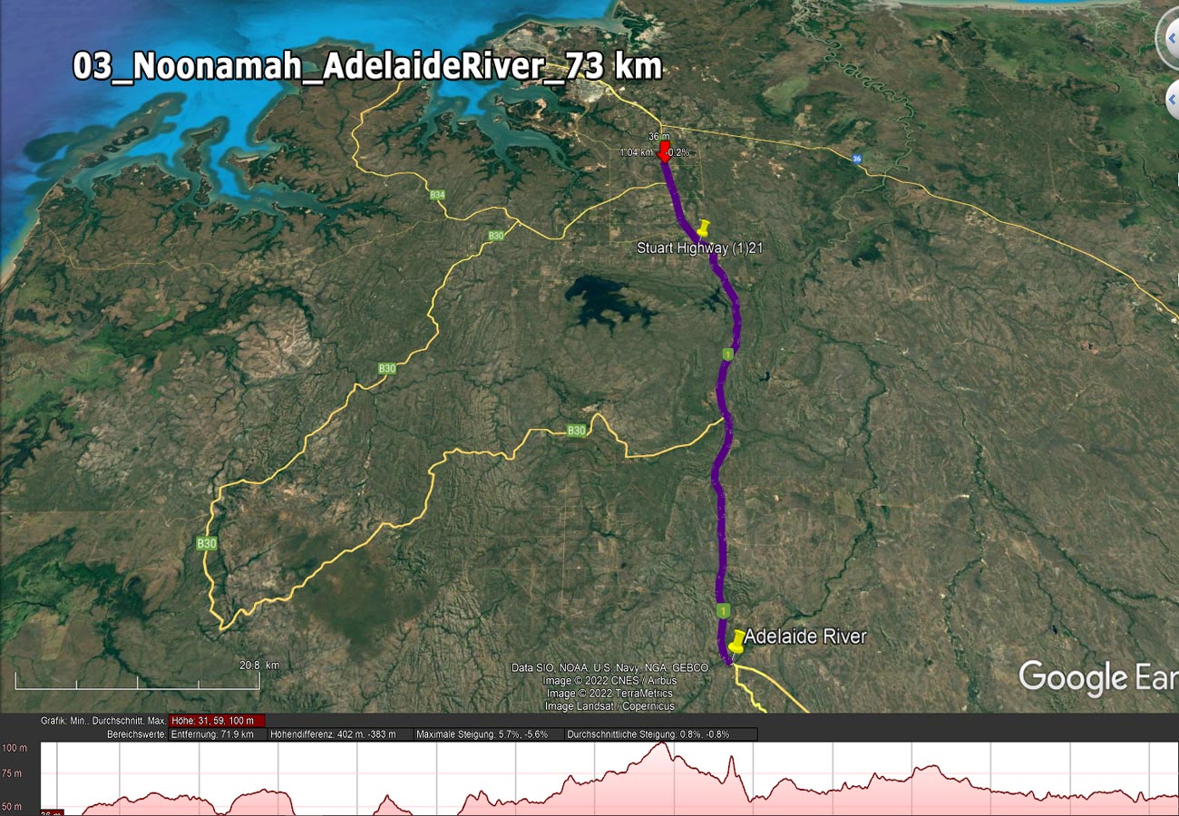
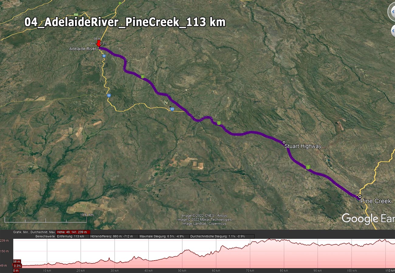
Mein Start wird Anfang September 2022 in Darwin sein. Danach 
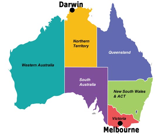
fahre ich durch 3 australische 
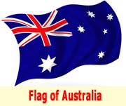
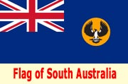
Bundesstaaten - Northern Australia, South Australia, Victoria -  ca. 4000 km bis nach Melbourne. Die höchste Erhebung wird knapp über 800 m Sh. sein.

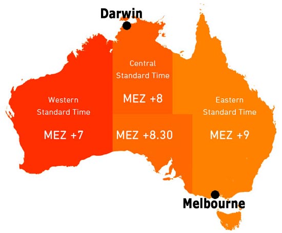
Ich durchquere auch 3 Zeitzonen. Wenn es in Mitteleuropa 12 Uhr ist, ist es z.B. in Darwin 20 Uhr. Die Australische-Zeitzonentafel finden Sie etwas weiter unten auf dieser Seite.

In Australien gibt es auch eine Sommer- und Winterzeit.
https://www.zeitumstellung.in/australien-2022


Gesamtstrecke - Google Earth - *.kml Datei
 

Fahrtroute Wetter

01_Darwin

Strecke - *.pdf Datei
Streckenbild - *.jpg Datei
Google Earth - *.kml Datei
 

02_Darwin - Noonamah

Strecke - *.pdf Datei
Streckenbild - *.jpg Datei
Google Earth - *.kml Datei
 

03_Noonamah - Adelaide River

Strecke - *.pdf Datei
Streckenbild - *.jpg Datei
Google Earth - *.kml Datei
 

04_Adelaide River - Pine Creek

Strecke - *.pdf Datei
Streckenbild - *.jpg Datei
Google Earth - *.kml Datei
 

05_Pine Creek - Katherine

Strecke - *.pdf Datei
Streckenbild - *.jpg Datei
Google Earth - *.kml Datei
 

06_Katherine - Mataranka

Strecke - *.pdf Datei
Streckenbild - *.jpg Datei
Google Earth - *.kml Datei
 

07_Matarenka - Daly Waters

Strecke - *.pdf Datei
Streckenbild - *.jpg Datei
Google Earth - *.kml Datei
 

08_DalyWaters - Elliott

Strecke - *.pdf Datei
Streckebild - *.jpg Datei
Google Earth - *.kml Datei
 

09_Elliott - Renner Springs

Strecke - *.pdf Datei
Streckenbild - *.jpg Datei
Google Earth - *.kml Datei


10+11_Renner Springs - Tennant Creek

Strecke - *.pdf Datei
Streckenbild - *jpg Datei
Google Earth - *.kml Datei
 

12_Tennant Creek - Wauchope

Strecke - *.pdf Datei
Streckenbild - *.jpg Datei
Google Earth - *.kml Datei


13_Wauchope - Barrow Creek

Strecke - *.pdf Date
Streckenbild - *.jpg Datei
Google Earth - *.kml Datei
 

14+15_Barrow Creek - Aileron

Strecke - *.pdf Datei
Streckenbild - *.jpg Datei
Google Earth - *.kml Datei


16_Aileron - Alice Springs

Strecke - *.pdf Datei
Streckenbild - *.jpg Datei
Google Earth - *.kml Datei
 

17_AliceSprings - Stuarts Well RH

Strecke - *.pdf Datei
Streckenbild - *.jpg Datei
Google Earth - *.kml Datei


18_Stuarts Well RH - Erldunda RH
 
Strecke - *.pdf Datei
Streckenbild - *.jpg Datei
Google Earth - *.kml Datei


19_Erldunda RH - Kulgera

Strecke - *.pdf Datei
Streckenbild - *.jpg Datei
Google Earth - *.kml Datei
 

20_Kulgera - Marla RH

Strecke - *.pdf Datei
Streckenbild - *.jpg Datei
Google Earth - *.kml Datei


21_Marla RH - Coober Pedy

Strecke - *.pdf Datei
Streckenbild - *.jpg Datei
Google Earth - *.kml Datei
 

22_Coober Pedy - Glendambo

Strecke - *.pdf Datei
Streckenbild - *.jpg Datei
Google Earth - *.kml Datei


23_Glendambo - Pimba

Strecke - *.pdf Datei
Streckenbild - *.jpg Datei
Google Earth - *.kml Datei
 

24_Pimba - Port Augusta

Strecke - *.pdf Datei
Streckenbild - *.jpg Datei
Google Earth - *.kml Datei
 

25_Port Augusta - Port Pirie

Strecke - *.pdf Datei
Streckenbild - *.jpg Datei
Google Earth - *.kml Datei
 

26_Port Pirie - Port Wakefield

Strecke - *.pdf Datei
Streckenbild - *.jpg Datei
Google Earth - *.kml Datei
 

27_Port Wakefield - Adelaide

Strecke - *.pdf Datei
Streckenbild - *.jpg Datei
Google Earth - *.kml Datei
 

28_Adelaide - Tailem Band

Strecke - *.pdf Datei
Streckenbild - *.jpg Datei
Google Earth - *.kml Datei


29_Tailem Band - Coonalpyn

Strecke - *.pdf Datei
Streckenbild - *.jpg Datei
Google Earth - *.kml Datei
 

30_Coonalpyn - Keith

Strecke - *.pdf Datei
Streckenbild - *.jpg Datei
Google Earth - *.kml Datei
 

31_Keith - Kaniva

Strecke - *.pdf Datei
Streckenbild - *.jpg Datei
Google Earth - *.kml Datei


32_Kaniva - Horsham

Strecke - *.pdf Datei
Streckenbild - *.jpg Datei
Google Earth - *.kml Datei
 

33_Horsham - Ararat

Strecke - *.pdf Datei
Streckenbild - *.jpg Datei
Google Earth - *.kml Datei
 

34_Ararat - Ballarat

Strecke - *.pdf Datei
Streckenbild - *.jpg Datei
Google Earth - *.kml Datei
 

35_Ballarat - Melbourne

Strecke - *.pdf Datei
Streckenbild - *.jpg Datei
Google Earth - *.kml Datei


Australia-Map

Zeitzonen


Uhrzeitvergleich
ÖSTERREICH

AUSTRALIEN
Darwin +7,5 Std.

Melbourne +8 Std.

.

Australian aboriginal music


Australien-Infos